Here is the image that Due puts up - which is, as advertised, an apparent 2.5 meter resolution.

Here is a current frame from Google - and it is obviously MUCH higher resolution - either 6" or 1.0' resolution - difficult to say exactly without a lot of time and effort.
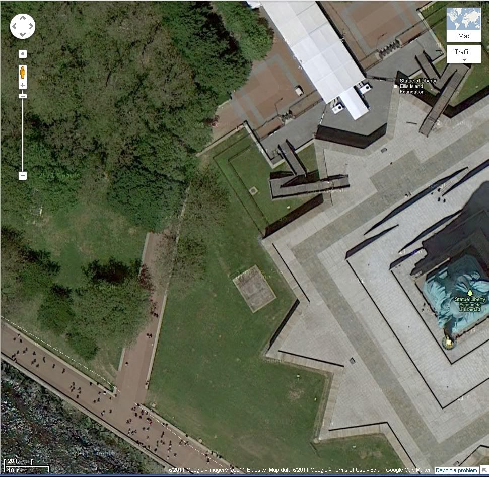
http://maps.google.com/maps?q=Ellis+Island,+New+York&hl=en&ll=40.689708,-74.045109&spn=0.000864,0.001479&sll=37.0625,-95.677068&sspn=60.635244,52.558594&vpsrc=6&hnear=Ellis+Island,+New+York,+Hudson,+New+York&t=h&z=20
I think even a casual observer can tell the difference between even the highest available (commercial) grade satellite resolution - and that which Google is using. Note that Google SWITCHES datasets - in fact does a 'merging' - during the zoom-in/zoom-out function - from a low res dataset for very wide aperture views, to the higher res datasets as zoom function increases. The MAJORITY of the current US low-res dataset utilized by Google is the 30m Landsat dataset. The entire state of Texas is easily available online, both Landsat, and higher res USDA aerial recon - both orthorectified, with proper 'image' info in the geo-tiff headers.
Other states - some are easy to access, some are not. MIT used to have a mega-server with these USDA (and Landsat) geo-tiffs - probably still do. The USDA used to serve these directly also - and the data-sets that the USGS were serving (many times at a price) were usually nothing more than the USDA datasets - packaged a little differently.
There is a lot of info about images in the raw and processed geo-tiff headers - info that most 'image viewers' do NOT access.
So, basically, I stand by my original post - with acknowledgement to Due that, yes, there ARE higher resolution satellite imagery available - but it costs.

Finally, brethren, whatsoever things are true, whatsoever things are honest, whatsoever things are just, whatsoever things are pure, whatsoever things are lovely, whatsoever things are of good ...
